What does the pressure in a hurricane mean? When you talk about “pressure” in a hurricane, you refer to the atmospheric pressure at the very core of the hurricane.
Hurricanes are massive, but there is a significant reduction in pressure near the center, or the eye.
Like a massive air whirlpool, the reduced pressure draws nearby objects in.
But, what does the pressure mean in a hurricane? And how everything changes with low or high pressure?
A lower pressure indicates a more intense hurricane, like a super vacuum cleaner, as it sucks forcefully when the suction power is high.
What Does the Pressure in a Hurricane Mean?
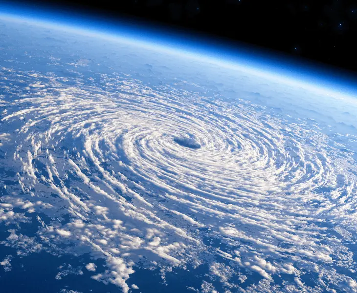
The pressure in a hurricane has a big role to play in how devastating it can be. Its suction power changes with a change in the pressure in its center.
Atmospheric pressure is measured in millibars. It is used by meteorologists when describing the air or barometric pressure in storms.
It provides a useful measure of its intensity. But, what does the mb pressure mean in a hurricane?
To get an idea, you need to learn a bit more about the Saffir-Simpson scale of hurricane intensity.
The Saffir-Simpson Scale
This scale of hurricane intensity determines the classification of hurricanes.
It includes a central millibar or “mb” measurement of the air pressure, expected wind speeds, and the storm surge’s height.
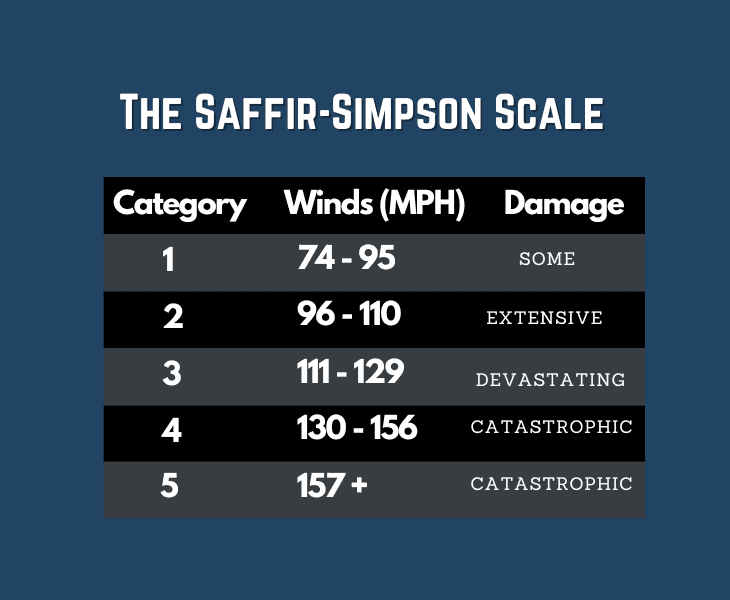
Based on these changing pressures, it is possible to categorize hurricanes.
For instance, a Category 1 hurricane that would cause minimal damage has a barometric pressure of over 980 millibars.
On the other hand, a Category 5 with the potential for massive damage has a much lower central pressure of 920mb.
Fact: A hurricane's path can be altered by high pressure systems surrounding the storm, and when in place, these mechanisms prevent hurricanes from making landfall.
Factors Influencing Hurricane Pressure
The interplay of four factors influences hurricane intensity:
- Warm Ocean Temperatures
- Atmospheric Conditions
- Wind Shear
- Coriolis Effect
Let’s discuss more about these factors to understand how hurricanes are categorized:
Warm Ocean Temperatures
Hurricanes begin life as tropical cyclones low in the atmosphere over equatorial warm ocean waters.
In the right conditions, they form when the temperature of the upper 200ft (60m) of the water is over 79°F (26oC).
A cyclone’s existence depends on receiving a steady supply of thermal energy, heat.
With an unlimited supply in the tropics, they have the fuel to develop into hurricanes when the atmospheric pressure at its base is low enough to draw in warm moist air.
Huge storm clouds are generated as the warmed water vapor moves upwards into colder air to eventually cool and condense.
Atmospheric Conditions
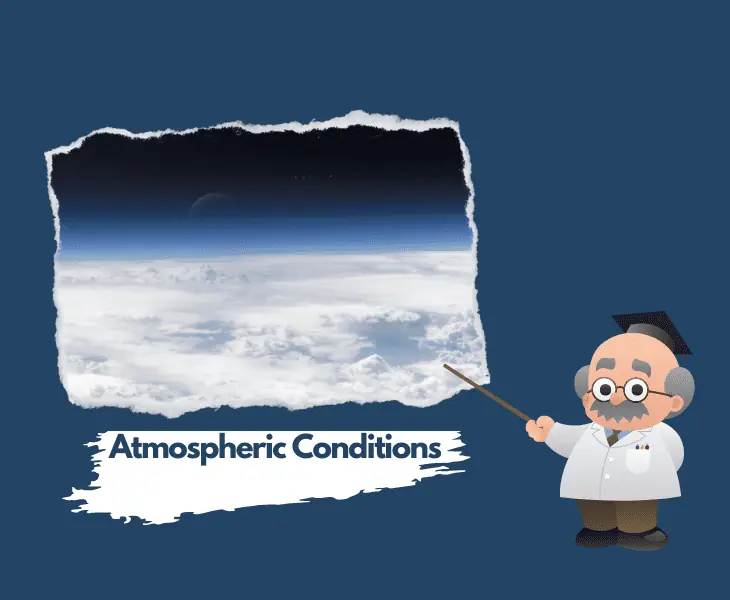
As well as needing specific water temperatures to form, the atmospheric conditions need to be right.
They drive the formation of convection cells as cool liquid water falls back to earth and warm water vapor rises.
With the heat, the air expands and becomes more buoyant and less dense than the air around it.
Then the heat is transported upwards and warm moist air is pulled in to replace it.
The process lowers the air pressure at the center of the storm and in the attempt to equalize it, the air current moves from high to low pressure triggering rotation.
Wind Shear

Wind shear is characterized by a change in the wind’s speed and/or its direction.
It is associated with strong temperature and density variation and the winds can change to run horizontally or vertically at high or low altitudes.
A strong vertical wind shear can blow the tops of the storm clouds hundreds of miles downstream and tilt the spinning column of air disrupting the fuel supply of warm moist air.
Horizontal wind shear occurs over the surface of the ocean.
In this case, the storm can be blown out of existence by the strong multi-directional winds or pushed to more favorable storm-producing conditions.
Coriolis Effect
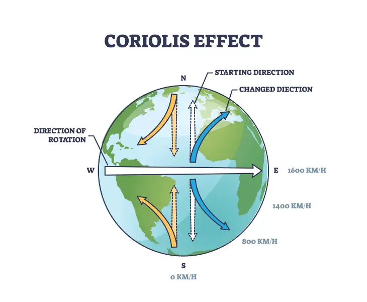
Because the Earth is tilted on an axis, we experience an apparent force called the Coriolis Effect.
The Coriolis Effect makes objects traveling long distances appear to move in a curve and not a straight line.
Its effect is greater at the equator where it creates large-scale weather patterns as it deflects the direction of the wind to the right in the northern hemisphere and to the left in the southern.
In the northern hemisphere, the Coriolis Effect forces winds to blow anticlockwise around low pressure and clockwise around high pressure and this makes the hurricane spin.
Fact: A hurricane's strength can be drastically altered by even a slight shift in atmospheric pressure, and the wind can pick up considerably with even a slight reduction in pressure.
Low Pressure in a Hurricane and Its Impact
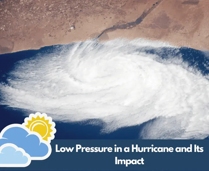
Wind speed in a hurricane is directly related to the surface pressure of the storm and pressures in tropical cyclones are among the lowest recorded at sea level.
The lowest ever recorded was Hurricane Wilma with 882 millibars. As cyclones build and gather to become hurricanes the wind blows faster.
Then, they are deflected and rotate around the low atmospheric pressure center forming the hurricane’s wall and eye.
What Does Falling Pressure Suggest?
Falling barometric pressure is a signal that a storm is intensifying reaching higher wind speeds with greater danger.
Once there are sustained winds over 64 knots, the cyclone is a Category 1 hurricane.
Air pressure and wind speeds change across the diameter of a hurricane.
The pressure at the eye wall is high compared to the 990 to 1010 millibars at the storm’s calmer center.
The pressure falls gradually moving away from the center towards the eye wall and the speed of the wind increases.
High Pressure in a Hurricane and Its Impact
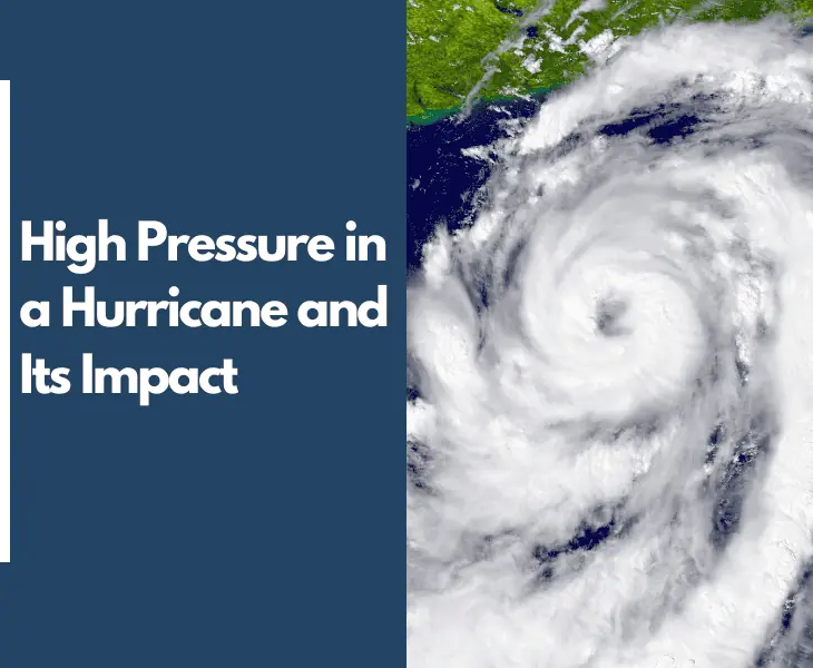
Hurricanes, typhoons and tropical cyclones are the same phenomena.
All have high winds rotating around low pressure, with the Coriolis Effect influencing the direction of rotation.
The intensity of a tropical cyclone is determined by the maximum sustained wind speed or its lowest barometric pressure.
It is a relationship often described as near symmetrical.
However, the air pressure in and around the hurricane varies and the air current is subjected to pressure gradient force with the gradient impacting the rate of change.
The greater the gradient, the faster the air moves to try and equalize the pressure while the hot air rises through cold in attempt to equalize the temperature.
There is high air pressure above the hurricane and it is sucked down into the eye from above driving the storm further.
Does High Pressure Mean a Storm?
Areas of high pressure are called anticyclones. Generally, they create cold, crisp winter days and in summer, clear blue skies.
High pressure means the air is dense, moist and heavy. It sinks at different rates through the air, so it is also unstable.
In late winter or early spring, the air near the ground cools so much it forms a thick fog. With only light winds to disturb it, it lingers.
In such conditions, there is a temperature inversion, with cold air underneath and warm above trapping it.
The sky seems overcast, there’s haze and mist, rising pollution, and poor visibility but no storm.
Fact: If the hurricane is pushed over cooler water, makes landfall or develops strong wind shear, it will dissipate and the barometric pressure increases as a result.
Examples of Hurricanes with High Pressure
Where a high-pressure zone originates impacts the type of weather to come, but unlike low pressure and its active weather systems, high pressures do not cause stormy weather.
Winds blow away from high pressure areas, the atmosphere is drier.
The sinking air increases the pressure and raises the temperature, clouds dissipate and there is less chance of rain.
Two Examples of High-Pressure Storms
Typically, air pressure is somewhere between 1000 and 1030 mb but in 1968 a huge anticyclone over Agata in Siberia reached pressures of 1083mb, the highest recorded until re-evaluated in 2012 after another high-pressure event in Mongolia in 2001.
The Siberian high, a semi-permanent anticyclone over the northeast of the continent forms surface layers of air that are intensively cooled by approaching winter temperatures.
It rarely makes it to altitudes of 10,000 feet.
Fact: At Tsetsen-Uul, in 2020, the mean sea-level pressure rose to 1,094.3 mb with frigid temperatures as low as minus -45.5 oC.
Takeaway
What does the pressure in a hurricane mean? The magnitude of hurricane damage often depends on the storm’s pressure.
Hurricanes with lower central pressure tend to be more powerful and catastrophic.
This millibar pressure is one of many components that help create and strengthen the storm, including the warm water temperatures, favorable atmospheric conditions, wind shear, and the Coriolis Effect.
You can learn a lot about a hurricane’s strength, destructive capability, and anticipated after-storm weather from its pressure.