Why do clouds look flat on the bottom? The physical structure, size, and color of clouds assist in anticipating the next weather trend.
This blog will discover how clouds form and why they have a flat bottom foundation.
Keep reading!
Water vapor stays invisible when heated air rises until it cools enough to condense into water droplets. The height at which this occurs denotes the cloud’s bottom. As additional air flows in from below, fresh clouds will develop, preserving the flat bottom.
Why Do Clouds Look Flat on the Bottom?

The answer depends on the mechanics of cloud generation, which is much more complex than a basic weather analysis based on cloud shape.
Cloud Physics is organized around two basic concepts.
Cloud-Scale:
The development of a cloud is governed by its size, the environment around it, wind shear, turbulence, and temperature change.
Micro Scale:
Changes occurring within a few centimeters of the cloud surface aid in identifying the cloud scale.
The Micro Size refers to this minuscule fractional scale of measurement and observation.
The Mechanism of Cloud Formation.

Clouds are made up of tiny water droplets and ice particles. These are light enough to float in the air.
Clouds occur as a consequence of a variety of atmospheric events as follows:
Evaporation
It occurs when water from the earth’s surface evaporates owing to increasing temperatures and begins to move upward with the wind.
As altitude increases, so does the temperature and air pressure.
Because water cannot sustain its vaporized condition, it condenses into ice crystals and droplets.
The mix of these small icicles with cloud water droplets.
Condensation Nuclei
Water vapor may carry particles such as dust and pollen.
When they reach a high enough altitude, the moisture condenses on the particles, forming condensation nuclei.
Clouds then develop in the vicinity of these nuclei.

Because of the high wind speed in steep terrains, moist air is often driven to ascend to higher elevations, resulting in the development of clouds.
This is known as the Windward and Leeward Side Phenomena.
So, why do some clouds look flat on the bottom?
When the wind blows into a low-pressure zone and cannot go out, low-pressure clouds emerge.
This produces a drop in temperature as well as a pressure drop, resulting in mid-altitude clouds.
When cold air drives a significant volume of warmer air into higher altitudes, an abrupt shift in atmospheric pressure occurs, creating exceptionally enormous clouds and thunderstorms.
At the height of condensation, the cloud’s bottom flattens out. A boundary layer forms between clouds and hot ascending air at this height.
This is often referred to as the Lifted condensation level (LCL). When cooled via dry adiabatic lifting at LCL, the relative humidity of the air parcel becomes saturated.
This LCL is used to calculate the cloud base.
Four Main Ways of Cloud Formation

The main reason why clouds look flat on the bottom is cloud formation. There are four ways of cloud formation.
Let us take a look.
1. Convection
When a parcel of air is heated, it expands and becomes less dense than the surrounding air, causing it to rise.
This is known as a convection current. Contact with a warm sea or ground might cause local warmth.
The parcel will increase until its temperature exceeds that of the surrounding air.
During the ascent, the ascending air is cooled adiabatically, and when it is cooled below the dew point, condensation occurs, resulting in the development of cumulus convection clouds.
If the rise of air is rapid, towering cumulus clouds will emerge.
If the rise of air is rapid, towering cumulus clouds will emerge. Cumulonimbus clouds may develop with their heads deep into the high cloud level until they reach the tropopause if the ascent is rapid.
Because the cloud cannot ascend over the tropopause, it spreads horizontally and resembles an anvil.
This is referred to as an anvil-shaped cumulonimbus.
2. Turbulence

Strong winds blow across uneven terrain and collide with diverse objects. As a result, the air is deflected upwards.
The atmosphere is cooled adiabatically as it rises. Clouds occur when temperatures fall below the dew point.
This happens when wet air flows over cold, uneven terrain.
Wind speeds of more than 13 knots may cause sea waves of sufficient height to build turbulence clouds at sea.
These stratus clouds have a base height of little more than 600m.
3. Frontal Lifting
When a warm and cold air mass collides, the line of separation at sea level is referred to as a front.
The dividing line between them is not vertical. It is drawn to cooler air because it is denser than warmer air.
This slanted border serves as a wedge, lifting the heated air. The slope of a warm front is moderate, and the ascending warm air generates stratiform clouds.
When a cold front approaches, the steep slope, and then up sliding warm air create cumulonimbus and cumulus clouds.
4. Clouds of Orography

When a warm, wet wind blows on a mountain range, it starts to climb the mountain.
It cools adiabatically during its climb, and after chilling below its dew point, orographic clouds develop.
These are also stratus in nature. Further elevation leads to nimbostratus and continual precipitation if the peak is sufficiently high.
Clouds are growing steadily on the windward side, while clouds evaporate at the same pace as the descending air becomes adiabatically warmed and clouds evaporate.
What are The Factors Affecting Clouds Structure?
There are several factors that influence the shape of the clouds; these are:
1. Temperature
The warmer air mass rising with height traps the colder air mass below it.
When the dew point is achieved, thin clouds create a visible border between the two masses affecting cloud size and structure.
2. Solar Radiation
Solar radiation affects the size and structure of the clouds by driving the process of convection, which is a part of the process.
The warmth from the sun causes the particles in the air to become warmer; consequently, the more generous air assists in forming the clouds.
3. Factories and Industrial Plants

The structure of clouds is also significantly influenced by factories, which are another important source.
Most manufacturing facilities have chimneys that release significant quantities of smoke and other pollutants.
Consequently, those gasses often combine with the clouds in the sky, changing the clouds’ structure.
4. The Wind
It is very important to remember that the direction in which the wind blows affects the clouds’ structure.
Because of the wind blowing direction, there are times when the clouds travel horizontally, and there are other times when they move vertically.
For instance:
Clouds may travel vertically as well. We sometimes observe a cloud hanging low in the sky, gradually rising higher.
It is produced by hot air rising from below, a process called convection.
Clouds in such situations tend to travel higher, where the air is colder.
Clouds travel vertically as water vapor condenses at various heights while being pushed by the wind.
This process affects the structure of the clouds. Meteorologists essentially utilize the pace at which clouds move to forecast the weather.
FAQs About Why Do Clouds Look Flat On the Bottom?

Do you have other questions about why clouds look flat on the bottom?
Please keep us informed. Here are some of the most commonly asked questions about cloud structure.
Which Clouds have Flat Bottoms?
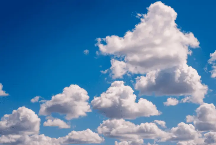
Cumulus clouds, those fluffy clouds that appear in the sky on hot days, particularly in the summer, have flat bottoms.
It’s due to the way they develop. They occur at the tops of warm air columns ascending into the sky from the ground.
Why Do Certain Clouds Seem to be Low?
Cloud formation occurs when the lighter warm air is pushed to ascend above the cold air mass.
The dropping clouds suggest that a front is approaching, bringing rain during the following 12 hours.
A stratus cloud is a low continuous cloud sheet that covers the sky.
How Do Clouds Appear Before a Tornado?
In many respects, tail clouds resemble a funnel or a tornado. They are often bent on an axis that is neither horizontal nor vertical.
While not inherently hazardous, tail clouds, like wall clouds, usually indicate severe weather and probable tornadic activity.
Read Next: Can You Tan Through Clouds?
Final Verdict.
Why do clouds look flat on the bottom? Because air temperature rises, water vapor is invisible, but it may condense into visible droplets of water if the air cools enough.
The depth of the cloud may be determined by the height at which this occurs.
If there is an increase in the air from below, fresh clouds will develop and maintain the flat bottom. Thanks for reading!